MapsSeattle & the Region

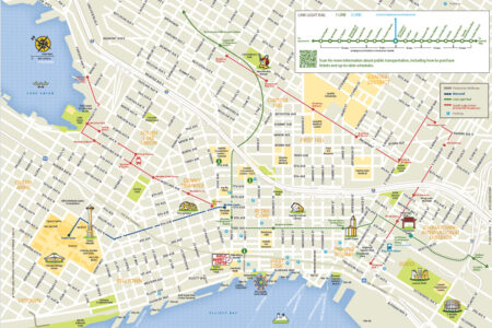
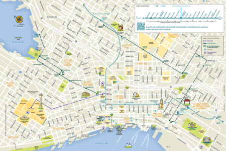
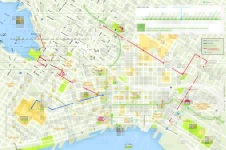
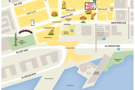
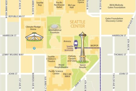
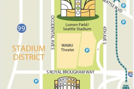
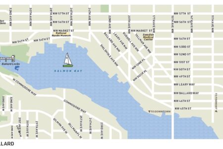
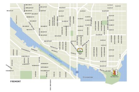
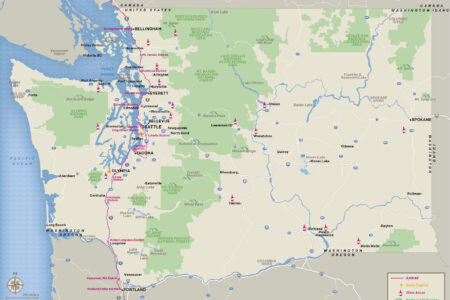
Downloadable maps of Seattle, the Puget Sound region and Washington State

Illustrated map of downtown Seattle showing landmarks, bus and streetcar routes, LInk Light Rail, parks, piers, and notable neighborhoods like Capitol Hill, South Lake Union, and Pioneer Square, with a route legend in the corner.

Downtown Seattle

Illustrated downtown Seattle map showing landmarks, parks, attractions, and the Link light rail route from Northgate to Angle Lake, with ferry terminals, waterfront, Pike Place Market, and major neighborhoods labeled.

Downtown Seattle Let's Play SEA26

Illustrated map of Pike Place Market in Seattle, showing main streets, the market area, the iconic sign, waterfront, nearby buildings, and walking paths. Key locations like public restrooms and parking areas are marked.

Pike Place Market Detail

Colorful map of Seattle Center showing landmarks like the Space Needle, Climate Pledge Arena, museums, theaters, parks, and nearby streets including Mercer St, 5th Ave N, Denny Way, and Harrison St.

Seattle Center

Map of Seattle's Stadium District showing Lumen Field, WAMU Theater, and T-Mobile Park, nearby streets, parking lots, train stations, and bus stops, with icons for transportation and landmarks.

Stadium District

Map of Ballard in Seattle showing streets, Salmon Bay with a sailboat icon, Ballard Locks, and nearby areas. Major streets and landmarks, including the Swedish Medical Center, are labeled.

Ballard Neighborhood

Illustrated map of Fremont, Seattle, showing streets, Fremont Cut, and landmarks including the Fremont Troll and Gas Works Park, with parks, water, and key roads highlighted.

Fremont Neighborhood

map of Seattle University District

University District

Illustrated map of Seattle and surrounding areas, showing major neighborhoods, highways, parks, and Puget Sound. Notable areas include Capitol Hill, Queen Anne, West Seattle, Bellevue, and landmarks like Space Needle and Pike Place Market.

Puget Sound Region

Map of Puget Sound, Washington, highlighting major cities like Seattle, Tacoma, and Olympia. It shows ferry routes, trails, airports, wineries, ferries, marinas, and parks. The map also indicates travel distances between key locations.

Western Washington

Map of Washington state, highlighting cities, national parks, and state routes. Seattle and Spokane are marked, with forests and mountains depicted. Railroads and geographical features like the Columbia River are also shown.

Washington State

Subscribe to the Seattle Localist

Seattle’s best every month in your inbox

  • This field is for validation purposes and should be left unchanged.

Book Your Trip

Advertisements